Description
Introduction of RealityCapture for Point Cloud Processing
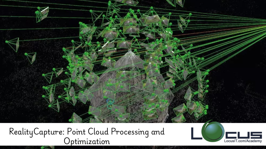
This course focuses on the techniques and best practices for processing and optimizing point clouds in RealityCapture, a leading photogrammetry software. Point clouds are critical for creating 3D models from photographs or laser scans, and RealityCapture excels in turning these point clouds into accurate, high-quality 3D meshes and models. This course will guide you through the process of capturing, refining, and optimizing point cloud data, enabling you to generate more detailed and precise models for various applications, including surveying, construction, and cultural heritage preservation.
Prerequisites
- Basic understanding of photogrammetry and 3D modeling concepts
- Familiarity with RealityCapture software interface
- Basic knowledge of point cloud data formats and processing workflows
- Familiarity with creating 3D models from images or scans (preferably)
Table of Contents
1. Introduction to Point Cloud Processing
1.1. What is a Point Cloud?
1.2. Importance of Point Clouds in 3D Modeling
1.3. Overview of RealityCapture’s Point Cloud Capabilities
2. Capturing High-Quality Point Cloud Data
2.1. Methods for Capturing Point Clouds (Photogrammetry vs. LIDAR)
2.2. Optimizing Camera Settings for Better Point Cloud Quality
2.3. Using Ground Control Points (GCPs) for Accuracy
3. Importing Point Clouds into RealityCapture
3.1. Supported Point Cloud Formats in RealityCapture
3.2. Preparing Data for Import
3.3. Importing and Aligning Point Clouds with Images
4. Processing Point Clouds in RealityCapture
4.1. Sparse vs. Dense Point Clouds: What’s the Difference?
4.2. Building Dense Point Clouds from Images
4.3. Optimizing Point Cloud Alignment
5. Cleaning and Refining Point Clouds
5.1. Removing Noise and Outliers from Point Clouds
5.2. Filtering Techniques for Improving Point Cloud Quality
5.3. Correcting Geometric Errors in Point Clouds
6. Point Cloud Optimization for 3D Modeling
6.1. Reducing Point Cloud Density without Losing Accuracy
6.2. Decimating Point Clouds for Faster Processing
6.3. Improving Mesh Detail and Texture Mapping
7. Working with Large-Scale Point Clouds
7.1. Managing Storage and Memory for Large Point Clouds
7.2. Optimizing Processing Time for Massive Point Clouds
7.3. Merging Multiple Point Clouds into a Single Model
8. Converting Point Clouds to 3D Models
8.1. Creating 3D Meshes from Point Clouds
8.2. Texturing and Rendering 3D Models from Point Clouds
8.3. Exporting 3D Models for Use in Other Software
9. Advanced Point Cloud Processing Techniques
9.1. Using Ground Control Points for Enhanced Georeferencing
9.2. Integrating Point Clouds with Other Types of Data (e.g., GIS, CAD)
9.3. Advanced Filtering and Mesh Optimization
10. Real-World Applications of Point Cloud Processing
10.1. Using Point Clouds in Construction and Infrastructure Projects
10.2. Point Clouds for Cultural Heritage Documentation
10.3. Surveying, Mapping, and Environmental Monitoring
11. Best Practices for Point Cloud Processing in RealityCapture
11.1. Workflow Tips for Efficient Point Cloud Processing
11.2. Common Pitfalls and How to Avoid Them(Ref: End-to-End 3D Model Creation with RealityCapture)
11.3. Ensuring Accuracy and Consistency in 3D Models
12. Case Studies: Point Cloud Processing in Action
12.1. Case Study 1: Point Cloud to 3D Model for Urban Planning
12.2. Case Study 2: Using Point Clouds for Structural Inspection
12.3. Case Study 3: Documenting Cultural Sites with Point Clouds
13. Future Trends in Point Cloud Processing
13.1. Advances in Point Cloud Technology and Software
13.2. The Role of AI and Automation in Point Cloud Optimization
13.3. Future Applications and Innovations in Point Cloud Data
14. Conclusion of RealityCapture for Point Cloud Processing
14.1. Recap of Key Concepts and Techniques in Point Cloud Processing
14.2. Moving Forward with Advanced Point Cloud Processing and Optimization
Conclusion
Point cloud processing is a vital skill for creating detailed and accurate 3D models, and RealityCapture provides powerful tools to streamline this process. By mastering the techniques covered in this course, users will be able to generate optimized point clouds for various applications, ensuring high-quality outputs for industries like surveying, construction, and cultural heritage preservation. As the technology evolves, the ability to efficiently manage and optimize point clouds will remain a crucial element in the creation of accurate 3D models and maps.


Reviews
There are no reviews yet.