Description
Introduction of RealityCapture for 3D Mapping
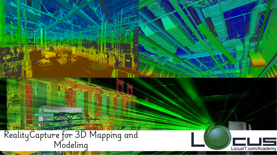
This course is designed for professionals looking to leverage RealityCapture for creating detailed, high-accuracy 3D maps and models. From aerial drone photography to terrestrial data capture, RealityCapture offers powerful tools for transforming images and scans into 3D representations for industries such as surveying, construction, and geospatial analysis. Learn how to use RealityCapture to streamline your 3D mapping and modeling workflows, improve project accuracy, and produce reliable outputs for a wide range of applications.
Prerequisites
- Basic knowledge of photogrammetry
- Familiarity with 3D modeling concepts
- Experience with RealityCapture or other 3D modeling software
- Understanding of geospatial data and mapping tools
Table of Contents
1. Introduction to 3D Mapping and Modeling
1.1. What is 3D Mapping and Modeling?
1.2. The Role of Photogrammetry in Modern Mapping Techniques
1.3. Overview of RealityCapture Features and Capabilities
2. Getting Started with RealityCapture
2.1. Setting Up RealityCapture for Your First Project
2.2. Importing and Organizing Image and Scan Data
2.3. Understanding Project Settings and Georeferencing
3. Image and Data Collection Techniques
3.1. Best Practices for Aerial Drone Photography
3.2. Using Terrestrial Scanning for Detailed Site Mapping
3.3. Gathering Data in Challenging Environments
4. Aligning Photos for 3D Model Creation
4.1. Aligning Images for Accurate 3D Reconstruction
4.2. Troubleshooting Alignment Issues
4.3. Using Ground Control Points (GCPs) for Increased Accuracy
5. Generating Point Clouds and Meshes
5.1. Creating Dense Point Clouds from Aligned Images
5.2. Generating 3D Meshes from Point Cloud Data
5.3. Refining Mesh Quality for Realistic Results(Ref: Optimizing Photogrammetry Projects with RealityCapture)
6. Texturing and Enhancing 3D Models
6.1. Applying Textures for High-Quality Visualization
6.2. Creating Seamless UV Maps for Texturing
6.3. Enhancing Detail with Normal Mapping
7. Working with Large-Scale 3D Models
7.1. Optimizing RealityCapture for Large-Scale Projects
7.2. Managing and Processing Massive Datasets
7.3. Techniques for Reducing Processing Time
8. Advanced Modeling Techniques
8.1. Refining Complex Geometries for Urban and Industrial Models
8.2. Integrating LiDAR Data with Photogrammetry
8.3. Using Mesh Repair and Smoothing Tools
9. Exporting 3D Models for Analysis and Visualization
9.1. Exporting Models to GIS and CAD Tools
9.2. Working with Game Engines and VR/AR Platforms
9.3. Integrating 3D Models into Digital Twin Systems
10. Post-Processing and Model Optimization
10.1. Cleaning and Improving Mesh Quality
10.2. Texture Optimization for Real-World Accuracy
10.3. Using RealityCapture’s Export Features for Efficient Workflow
11. Applications of 3D Mapping and Modeling
11.1. Surveying and Land Mapping
11.2. Construction Planning and Site Management
11.3. Environmental Monitoring and Conservation
11.4. Virtual Reality and Gaming
12. Troubleshooting and Problem Solving
12.1. Solving Alignment and Reconstruction Errors
12.2. Addressing Texture Mapping Issues
12.3. Handling Sparse and Noisy Data
13. Future Trends in 3D Mapping and Modeling
13.1. The Role of AI in 3D Reconstruction
13.2. Cloud-Based Solutions for Collaborative Modeling
13.3. The Future of 3D Mapping in Smart Cities and Infrastructure
14. Conclusion
14.1. Recap of Key Techniques and Skills
14.2. Future Learning Pathways in 3D Mapping and Modeling
Conclusion
RealityCapture is a powerful tool for creating precise, detailed 3D models and maps from photographs and laser scans. This course equips you with the knowledge to fully utilize its capabilities, enabling you to handle complex datasets and produce high-quality results for industries such as surveying, construction, and geospatial analysis. By mastering the tools for 3D point cloud generation, mesh creation, and texturing, you’ll be prepared to tackle a wide range of mapping and modeling challenges, whether for planning, analysis, or visualization purposes.


Reviews
There are no reviews yet.